Posted on September 26th, 2019 by Mary Lord
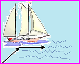
 Middle school students learn the concept of dead reckoning by using vectors to plot a course based on a time and speed, then correct their positions with vectors representing winds and currents. Includes a link to related activities on navigation and creating nautical charts.
Read More
Filed under: Class Activities, Grades 6-8, Lesson Plans | Comments Off on Vector Voyage!
Tags: Aerospace Engineering, Class Activities, Geography, GPS, Grades 6-8, Lesson Plan, Mathematics, nautical charts, naval engineering, navigation, Physics, teachengineering, vectors
Posted on August 14th, 2017 by Mary Lord
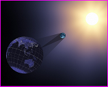
 On August 21, 2017, all of North America will be treated to a solar eclipse, including a 90-mile swath of totality stretching from Oregon’s coast to Charleston, S.C. NASA has assembled a helpful guide for where, when, and how to experience the eclipse, including tips for safe viewing.
Read More
Filed under: Class Activities, K-12 Outreach Programs, Special Features, Web Resources | Comments Off on Eclipse 101: What, Where, How?
Tags: Astronomy, eclipse viewing, Geography, History, Internet Resources, maps, NASA, Outreach, Resources for Teachers, solar eclipse, totality, Web Resources
Posted on August 17th, 2015 by ASEE
 Elementary students investigate major landforms (e.g., mountains, rivers) in groups of two. They build a 3D model of a landscape depicting several of these landforms. Once they have built their model, they act as civil and transportation engineers to build a road through the landscape they have created.
Read More
Filed under: Class Activities, For Teachers, Grades K-5, Grades K-5, Grades K-5, K-12 Outreach Programs, Lesson Plans | Comments Off on Carving Out the Landscape
Tags: activity, Civil Engineering, Geography, Landforms, Paper Mache, Transportation
 Middle school students learn the concept of dead reckoning by using vectors to plot a course based on a time and speed, then correct their positions with vectors representing winds and currents. Includes a link to related activities on navigation and creating nautical charts.


 On August 21, 2017, all of North America will be treated to a solar eclipse, including a 90-mile swath of totality stretching from Oregon’s coast to Charleston, S.C. NASA has assembled a helpful guide for where, when, and how to experience the eclipse, including tips for safe viewing.
 Elementary students investigate major landforms (e.g., mountains, rivers) in groups of two. They build a 3D model of a landscape depicting several of these landforms. Once they have built their model, they act as civil and transportation engineers to build a road through the landscape they have created.