Polar Ice
Lesson developed by Liesl Hotaling and presented at the 2017 NSTA STEM Forum and regional conference.
Grade level: 6 – 12
Time: Four 50-minute lessons
Summary
Students learn about the importance of the polar regions by connecting with scientists and the data generated by their cutting-edge research on penguins and ocean environments.
Introduction/Motivation
Polar regions influence our daily lives, including climate, shipping routes, and the supply of resources from fish to petroleum. This series of lessons, presented by ASEE member Liesl Hotaling at the National Science Teachers Association’s regional meeting in October and annual STEM Forum in July 2017, aims to engage students in understanding the importance of this region by connecting them with polar scientists and data generated by cutting-edge polar research. Click HERE for links to Hotaling’s presentation, activities, and other materials.
Lesson 1: Ocean Convergence: Let’s Get Together
Ocean convergence zones occur where water comes together in a specific area due to the meeting of two ocean currents or when the water meets the coastline. This often causes a build up in height of the surface. Anything floating at the surface collects in a convergence zone. The students will participate in a hands-on activity to explore how convergence zones collect particles in the water. Students will then look at Surface Current maps from Antarctica to find patterns in where convergence zones occur in the Palmer Deep area.
Lesson 2: Penguins Foraging: Where and Why?
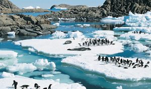
Adelie penguins forage by collecting Antarctic krill and returning to their nests to feed their chicks. Forage density is higher in convergence zones, as the penguins are more efficient at finding food. Students will experience foraging behavior of Adelie penguins by acting out foraging patterns and analyzing their data. The students will then look at distribution data of penguins foraging to determine what factors could influence the location of penguin foraging.

Lesson 3: Ocean Robots & Data: What? How? Why?
Gliders enable scientists to gather lots of information about ocean conditions, such as temperature, salinity, and phytoplankton, from the surface to the deepest reaches. Through a class demonstration, students will learn about how a glider works and then brainstorm how and why scientists use ocean robots to collect data.
Lesson 4: Investigating Why Penguins Forage There: Piloting Gliders
Through a hands-on activity, students will simulate a science team as they integrate data about surface currents and penguin movements to decide where to send the glider.
Polar-ICE Data Story: What drives patterns in ocean change?
The ocean varies immensely over space and time. But how can we understand what drives the patterns in the differences of the ocean over space and time? How might the differences influence what kind of animals lives where?
Polar-ICE is made possible by the support of the National Science Foundation Grant# PLR-1525635. http://polar-ice.org/
Project Polar Bear
Project Polar Bear is an international competition for middle and high school student groups taking action to fight climate change. Teams compete by creating a plan for a project that will help reduce reliance on fossil fuels and engage their communities. This can be a new project or a proposal to continue an existing project. Students and advisors track their progress during the competition through photos, research, and on social media. The top three high-scoring teams receive a grant of $1000, $750, and $300, respectively. For more information visit: www.polarbearsinternational.org
Filed under: Class Activities, Grades 6-8, Grades 9-12, Web Resources
Tags: Class Activities, Climate Change, Environmental Engineering, Grades 6-8, Grades 9-12, Lesson Plan, Liesl Hotaling, Marine Science, NSTA, oceanography, penguins, polar ice, polar research, Resources for Teachers


