Class Activity: Satellite Tracker
(Provided Courtesy of Teachengineering.org. Level: Grades 6-8. Time Required: 60 minutes. Expendable Cost Per Group.: US$ 1.00 or less if office supplies are available.

SUMMARY
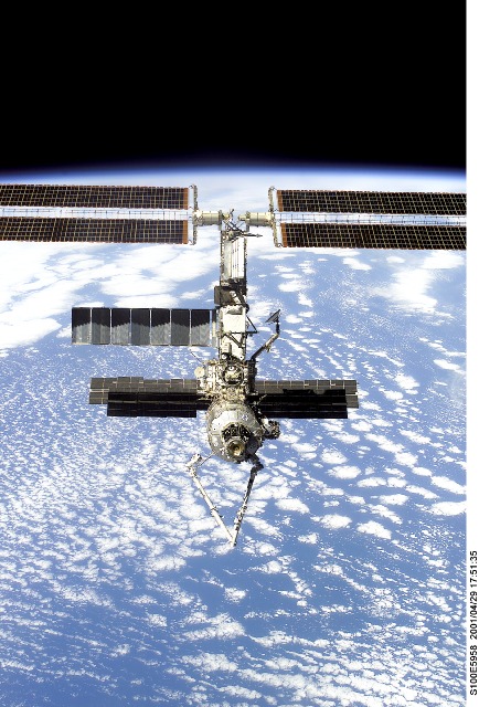
Students use satellite tracking software available on the Internet to monitor a very large satellite, the International Space Station. Using information from this online resource, students predict and graph the motion of the space station at their location and create a 3-D display of its path through the sky.
ENGINEERING CONNECTION
Engineers continue to seek safe and efficient ways of space travel. Software engineers work with aerospace engineers to create tools, such as the online tracking programs Skywatch and STSPlus, to advance their ability to make accurate plans. Engineers take advantage of the power of computers to create models and programs that help them analyze or create a design, or make long-range predictions using changing variables.
EDUCATIONAL STANDARDS
Colorado Math
1. construct two- and three-dimensional models using a variety of materials and tools; (Grades 5 – 8 ) [2005]
1. estimate, use, and describe measures of distance, perimeter, area, volume, capacity, weight, mass, and angle comparison; (Grades 5 – 8 ) [2005]
Colorado Science
Standard 5: Students know and understand interrelationships among science, technology, and human activity and how they can affect the world. (Grades 0 – 12)
Standard 4.4 Students know the structure of the solar system, composition and interactions of objects in the universe, and how space is explored. (Grades 0 – 12) [1995]
For other national standards, please check the lesson plan
LEARNING OBJECTIVES
After this activity, students should be able to:
• Understand the geometry of circles and ellipses.
• Define key navigational terms like azimuth, elevation, and range.
• Create 3-D models.
• Reading data from tables.
MATERIALS LIST
Each group should have:
• 2 foam balls (3-inches [7.6 cm] in diameter)
• Cellophane tape
• Masking tape
• Yard stick and or tape measure (groups can share)
• Protractor (the bigger the better; groups can share)
• Scissors
For the entire class to share:
• Computer(s) with internet access to the Skywatch website
PROCEDURE
For helpful background information on how engineers navigate satellites and on the International Space Station, please see the related lesson plans “Not So Lost in Space,” and “Life in Space: The International Space Station.” Also helpful is the Smithsonian Earth From Space online exhibit.
Introduction/Motivation
The International Space Station (ISS) is a very large satellite that orbits the Earth. It is 3,300 sq. ft. in area, and moves in an almost circular low-Earth orbit, about 250km above the surface of the Earth. In this activity, students will learn how to predict and track the ISS’ path using special computer software and how the paths of spacecraft and satellites can be calculated and accurately predicted. Using Skywatch and STSPlus, online tracking software, the unimaginable can be done. To create these programs, you need a college degree in Aerospace Engineering. But, fortunately, middle school students just need access to a computer to use these programs.
Vocabulary
Three key terms used in this activity are:
Azimuth – the number of degrees measured clockwise from the northern horizon. An object at 90 degree azimuth is due east. An object at 270 degree azimuth is due west.
Elevation – the height of an object, measured in degrees above the horizon. An object directly overhead is at a 90 degree elevation. An object on the horizon is at 0 degrees elevation.
Range – the distance from where you are located to a spacecraft or satellite.
Other keywords: navigation, space, orbits, satellite
Before the Activity
• Run the Skywatch program and pick a day within the next week or so for the students to find and track the ISS. Become familiar with the software before showing it to your students. See Troubleshooting Tips for more details.
• Mark a point in the center of the room that will represent your city. Using masking tape, mark a line pointing north from the city point.
With the Students
1. Introduce the students to the Skywatch website.
• Enter your city (or closest city) under Observer Location.
• Notice how Skywatch automatically adjusts to your latitude, longitude, and altitude.
Troubleshooting Tips
• Make sure the day of interest has a maximum elevation of significance. Any max elevation less than 60° will result in a less than impressive looking model.
• If you have too many data points, click on Variables and raise the Table Step Size to 30 or 40 seconds then recalculate your day of interest.
• If you feel the model is too low to the ground, add 5 feet (1.5 m) to every height to shift the model towards the ceiling.
ASSESSMENT
Pre-Activity Assessment
Matching: Have students “match” terms to definitions to assess their mastery of the subject.
Write the terms and the definitions of the three concepts listed below on six separate pieces of paper. Ask for six volunteer students to come up to the front of the room, and give each one of them a piece of paper. Have all volunteers read what is written on their papers one at a time. Have the audience match term to definition by voting. Have student “terms” stand by their “definitions.” At the end, give a brief explanation of concepts.
Azimuth – the number of degrees measured clockwise from the north horizon.
Elevation – the height, in degrees, above the horizon.
Range – the distance from where you are located to a spacecraft or satellite.
Activity Embedded Assessment
Brainstorming: In small groups, have the students engage in open discussion. Remind students that no idea or suggestion is “silly.” All ideas should be respectfully heard. Ask the students:
• Why do mission managers and engineers want to track satellites? (Possible answers: to predict when they will fall to Earth; to make sure they remain in their correct orbits.)
Post-Activity Assessment
Presentation: Ask two groups to present their models to the rest of the class. Discuss the 3-D model as a whole.
References
Skywatch program website: http://spaceflight.nasa.gov/realdata/sightings>
STSPlus program website: http://www.dransom.com/
For additional satellite lessons, see the Smithsonian Earth From Space page.
Contributors:
Penny Axelrad, Janet Yowell, Malinda Schaefer Zarske
Copyright
© 2004 by Regents of the University of Colorado.
The contents of this digital library curriculum were developed under a grant from the Satellite Division of the Institute of Navigation (www.ion.org) and National Science Foundation GK-12 grant no. 0226322.
Supporting Program
Integrated Teaching and Learning Program, College of Engineering, University of Colorado at Boulder
Filed under: Class Activities, Grades 6-8
Tags: Aerospace, Aerospace Engineering, International Space Station, Satellites


