Posted on April 20th, 2017 by Mary Lord
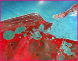
 It’s hard to top NASA for an out-of-this-world way to celebrate Earth Day 2017. The space agency is inviting people from around the globe to virtually “adopt” one of 64,000 individual pieces of Earth as seen from space by one of its 18 Earth science instruments.
Read More
Filed under: K-12 Outreach Programs, Special Features, Web Resources | Comments Off on “Adopt” a Piece of the Planet
Tags: Adopt a Planet, Aerospace, Climate, Earth Day 2017, Earth Science, Environmental Engineering, Environmental science, Events, Internet Resources, maps, NASA, Resources for Teachers, Satellite imagery, Web Resources
Posted on September 11th, 2011 by Jaimie Schock
 NASA’s Gravity Recovery and Interior Laboratory (GRAIL) mission will launch twin spacecraft in tandem orbits around the Moon to measure its gravity in unprecedented detail and create a gravitational map. GRAIL MoonKAM will allow classrooms to request pictures of the lunar surface from cameras on the twin satellites.
Read More
Filed under: For Teachers, K-12 Outreach Programs, Web Resources | Comments Off on Resource: Classroom on the Moon
Tags: Aerospace, Astronomy, Class Activities, NASA, Photo Gallery, Satellite, Satellite imagery, Satellites, Teacher Resources
Posted on March 27th, 2011 by ASEE
 Many kids dream of exploring space, but few get much further than their schoolyards. This is not true of students in Tekna-Theos, a Florida after-school program bursting with science activities and contests. They’ve set their sights high, designing and building mini-satellites and preparing a payload to test the effect of weightlessness on bone cells. Some have actually experienced “Zero-G.”
Read More
Filed under: Special Features | 3 Comments »
Tags: Aeronautics, Aerospace, Aerospace Engineering, Biomolecular Engineering, CubeSat, NASA, Satellite, Satellite imagery, Satellites, Space, Teachers
Posted on August 16th, 2010 by ASEE
 NASA’s Astronomy Picture of the Day Website is a helpful resource originated, written, coordinated, and edited since 1995 by Robert Nemiroff and Jerry Bonnell. The APOD archive contains the largest collection of annotated astronomical images on the internet.
Read More
Filed under: For Teachers, Grades 6-8, Grades 9-12, Grades K-5, K-12 Outreach Programs, Web Resources | Comments Off on Website: NASA’s Astronomy Picture of the Day
Tags: Astronomy, Images, NASA, Satellite imagery, Web Resources, Website
Posted on March 15th, 2010 by ASEE
The Center for Earth Resources Observation and Science (EROS) is a remotely sensed data management, systems development, and research field center for the U.S. Geological Survey, part of the U.S. Department of the Interior.
Teachers will find on the site aerial photography, satellite imagery, digitized maps and a vast image gallery, and well as online imaging programs such as EarthExplorer, the USGS Geographic Data Download, and the USGS Web Mapping Portal.
Read More
Filed under: Web Resources | Comments Off on Website: EROS Earth Satellite Images
Tags: Satellite imagery, U.S. Department of the Interior, U.S. Geological Survey
Posted on March 15th, 2010 by ASEE

NASA’s EarthKAM helps students learn about the Earth from the unique perspective of space. Through this interactive program, middle school students take part in photographing the Earth from a digital camera onboard the International Space Station. Educators are encouraged to register now for the upcoming April EarthKAM Mission.
Read More
Filed under: Grades 6-8, K-12 Outreach Programs | Comments Off on Website: Students Photograph Earth from Space
Tags: Aerospace, Grades 6-8, International Space Station, Satellite imagery
Posted on March 15th, 2010 by ASEE
 This online exhibit from the Smithsonian focuses on satellite images of the planet,with interactive pages on the categories: the living planet, water and air, structure of the land, the human presence, and satellite technology. Educators can also find a number of helpful lesson plans for different grade levels and online resources.
Read More
Filed under: Web Resources | Comments Off on Website: Smithsonian’s Earth From Space
Tags: Satellite imagery, Smithsonian Institution